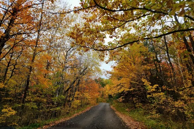
(KNSI) — The Minnesota Department of Natural Resources has released its week six fall color finder map, and leaf peepers are finding much of the state is in its full autumnal radiance.
If you’re looking for places to drive over the MEA weekend, the Duluth area from around Jay Cooke State Park up to Two Harbors is at 100% peak. Areas around Ely, Upper Red Lake, along the North Dakota border in the Red River Valley, just north of Alexandria, Starbuck, the southwestern corner of the state, areas along the Minnesota River, the Minnesota Wisconsin border along the St. Croix River, spots south of Faribault, and around Rochester are also at full peak.
North of Duluth along Highway 61 is past peak, as is the Lake Mille Lacs area, Lake of the Woods and far northwestern Minnesota, the Iron Range, Bemidji, Brainerd Lakes, and most of Stearns County.
Many places in the southern half of the state, including around St. Cloud, the St. Croix River Valley south of the Twin Cities and down to the Iowa border, are still at 50% to 75%.
___
Copyright 2024 Leighton Media. All rights reserved. This material may not be broadcast, published, redistributed, or rewritten, in any way without consent.


FOLLOW US FOR INSTANT UPDATES!


FOLLOW US FOR INSTANT UPDATES!