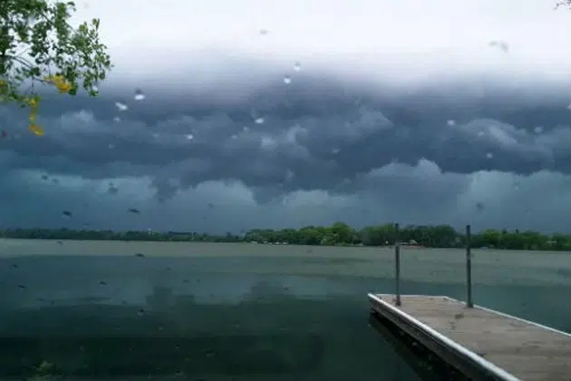
(KNSI) — Central Minnesota has a shot at more severe weather Wednesday afternoon.
Forecasters say storms are expected to develop along a cold front and pop in northeastern Minnesota around 4:00 then build south Wednesday evening. The St. Cloud area is in the slight or two out of five risk category.
The biggest threats are wind and hail.
Last week, the area also saw severe thunderstorms bubble up Thursday and Friday.
The National Weather Service says to have a way to get warnings later today.
___
Copyright 2023 Leighton Enterprises, Inc. All rights reserved. This material may not be broadcast, published, redistributed, or rewritten, in any way without consent.


Crews making progress containing Southern California wildfire
Winds had “dissipated a bit” since Friday, helping the efforts of fire crews.
2h ago

Frost clinch playoff spot with 6-5 victory
The Frost clinched their third straight playoff spot with a victory over Vancouver.
17m ago

Sign of spring: Lake Minnetonka declared open water for 2026
The Hennepin County Sheriff's Office Water Patrol and the conservation nonprofit Freshwater declared open water on the Twin Cities' largest lake.
56m ago

Hartman scores twice to lead the Wild to a 4-1 win
Ryan Hartman scored twice to lead the Minnesota Wild to a 4-1 win over the Ottawa Senators on Saturday. Jonas Brodin and Jake Middleton also scored for the Wild (43-21-12), and Jesper Wallstedt made 33 saves.
1h ago
FOLLOW US FOR INSTANT UPDATES!


FOLLOW US FOR INSTANT UPDATES!