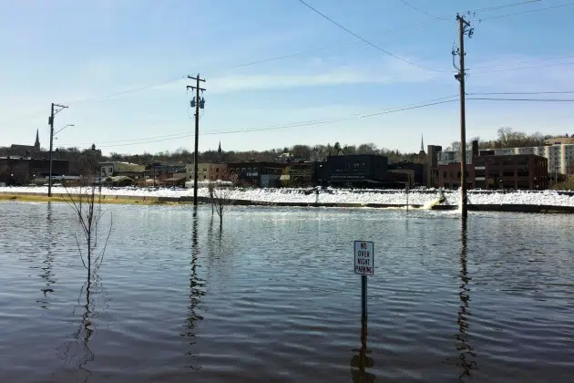
ST. PAUL, Minn. (AP) — Most of Minnesota should escape serious flooding over the next couple weeks, emergency managers said Wednesday, but cautioned that higher-than-expected rains in the coming days or rapid snowmelt in the Red River Valley could raise the threat.
“Right now we are entering what we hope to be the peak of this event, which should be occurring over the next week to 10 days,” said Dan Hawblitzel, meteorologist in charge at the National Weather Service in Chanhassen. “That is assuming — and that is an assumption — that we don’t have any more significant sources of precipitation. And unfortunately we can’t guarantee that.”
But he and other officials said at a briefing for reporters on Minnesota’s flood preparations that they and communities along the state’s major rivers have been preparing for weeks. They’ve been stockpiling sandbags, building dikes, closing low-lying roads and parks, and implementing action plans developed during past floods. And they said state and federal agencies are ready to provide more aid if necessary.
“The good news is the preparation is done,” Gov. Tim Walz said. “We’re ready to go.”
Minnesota is coming off one of its snowiest winters on record — the third snowiest in the Twin Cities. But Hawblitzel said the snow is “pretty much gone across most of the state.” The “notable exception,” he said, is the Red River basin, where there are still pockets with the equivalent of 1 to 3 inches of water in the snowpack. But he added that forecasters are not currently expecting a rapid melt there.
The St. Croix River at Stillwater has “basically leveled off” and should hold steady before gradually falling early next week, depending on whether significant rainfall arrives next week, Hawblitzel said.
The Mississippi River at St. Paul will be at major flood stage from the weekend through early next week. He said they’ll be watching closely because the river there is subject to upstream rainfall in both the Minnesota and Mississippi River basins. Heavier-than-expected rain Wednesday night and Thursday, or later next week, could push the crest up by a foot higher than forecast, he said.
The Red River of the North at Fargo-Moorhead “probably has the most uncertainly” due to the snow on the ground and its susceptibility to additional rain, he said, so they can’t rule out a crest of a foot higher than currently expected, or slightly more, depending on precipitation and melting patterns.
“If we can get though next week it does look like we should be able to get through this,” Hawblitzel said.
Communities on the North Dakota side of the Red River, such as Fargo and Grand Forks, and on the Wisconsin side of the Mississippi, such as La Crosse, have also been preparing. North Dakota Gov. Doug Burgum declared a statewide emergency last week. His office said Wednesday that drones from the Federal Aviation Administration will assist with monitoring flood levels, melt rates and ice jams.
The Minnesota Department of Health used the briefing to urge private well users to make sure they’re prepared in case their wells flood or already have. Flood waters often carry hazardous and toxic materials, Assistant Commissioner Cheryl Petersen-Kroeber said. Wells that flood should be presumed to be contaminated and the water should not be used for drinking, cooking or even tooth-brushing until they’ve been inspected and disinfected, she said. The department has posted advice on its website.
___
Copyright 2023 The Associated Press. All rights reserved. This material may not be published, broadcast, rewritten or redistributed.
Latest News


