(KNSI) — The National Weather Service has issued a winter storm watch for our area starting Tuesday afternoon.
Forecasters say heavy mixed precipitation is possible, with snow accumulations between 5″ and 10″ with a light glaze of ice tossed in.
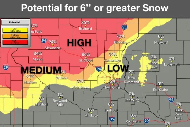
The heaviest snow is expected in western to central Minnesota from Tuesday afternoon through Wednesday morning, with the highest snow potential in western and central Minnesota. A tight snow gradient is expected on the southern side of the system, which is where Benton, Sherburne, Stearns and Wright counties are, with rain expected south of here.
Right now, there is a high potential for at least 6″ of wet, heavy snow. Despite temperatures in the mid 30s, heavy snowfall rates are expected to overcome the warmer temperatures, allowing snow to accumulate. Paved surfaces are likely to become slush covered, with accumulation favored on grassy areas.
The winter storm watch begins at 1:00 p.m. Tuesday but could be upgraded to a warning the closer the system gets.
___
Copyright 2025 Leighton Media. All rights reserved. This material may not be broadcast, published, redistributed, or rewritten, in any way without consent.


