(KNSI) – The National Weather Service says central Minnesota could see an extraordinary amount of rain over the next week.
That comes on top of a soggy spring and inch-plus that fell Saturday. The rain should start in the overnight hours and continue through all of Monday. Successive rounds will batter the area into next weekend. It may not be enough to warrant an ark but as much as five inches is expected to fall in isolated locations.
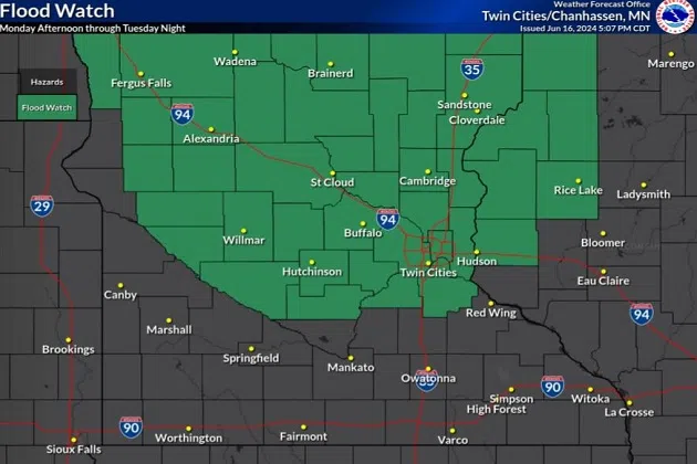
For the first time this year, Benton, Sherburne, and Stearns Counties will be under a flood watch beginning Monday at 1:00 p.m. and lasting until 7:00 a.m. Wednesday morning. NWS says training is possible, meaning that storms continue to form over the same spot without reprieve.
The phenomenon was seen in 2022 when it hit Randall in Morrison County. In July of that year, the Little Elk River spilled over its banks after receiving nearly a foot of rain in about 12 hours. Thirty homes had to be evacuated.
While that isn’t expected this week, we could get very heavy amounts on Monday and Tuesday. With the ground already saturated and rivers and lakes back at normal levels or already running high, it could create conditions for flash flooding.
___
Copyright 2024 Leighton Media. All rights reserved. This material may not be broadcast, published, redistributed, or rewritten, in any way without consent.


FOLLOW US FOR INSTANT UPDATES!


FOLLOW US FOR INSTANT UPDATES!