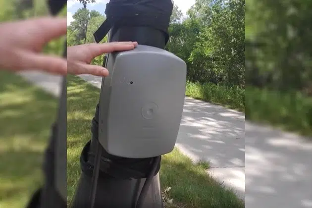
(KNSI) – The St. Cloud Area Planning Organization has counters along local walking and biking paths as they plan for the future of area trails. Associate Planner Alex McKenzie explained how the system counts pedestrians.
“It has two infrared sensors that when people cross over the trail, it counts the number of people. And then, it is connected by two tubes. That’s for bicyclists. So, when bicyclists go over it, it counts the number of people who are cycling.”
He was demonstrating the equipment along the Lake Wobegon Trail in Waite Park. McKenzie says the agency’s two counters stay in one location for a week every season. There are 18 different monitoring sites around the St. Cloud metropolitan area. He talked about how they will use the information.
“We use this data for seasonal averages. So we can see between seasons, how many people are using the facilities, you know, winter versus summer. And then also we like to see overall changes over time.”
The data will help the St. Cloud Area Planning Organization figure out where new sidewalks, bike lanes, shared-use paths, trails and all other infrastructure people use for walking and biking should go.
The St. Cloud Area Planning Organization is asking residents to fill out a survey on what they want to see to improve transportation in the St. Cloud area. To take the survey, click here.
___
Copyright 2022 Leighton Enterprises, Inc. All rights reserved. This material may not be broadcast, published, redistributed, or rewritten, in any way without consent.


FOLLOW US FOR INSTANT UPDATES!


FOLLOW US FOR INSTANT UPDATES!