Originally published 7:56 a.m. May 11th, 2022
Updated 8:11 a.m. May 11th, 2022
(KNSI) — Buckle up. It’s going to be a bumpy ride the next couple of days, weatherwise.
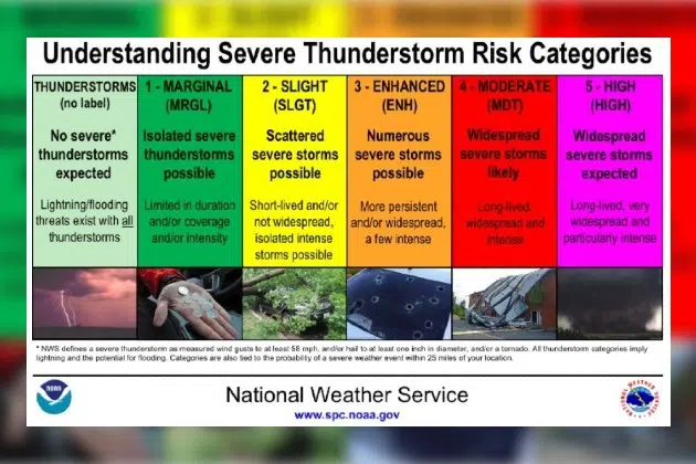
The Storm Prediction Center has central Minnesota in the enhanced risk area for severe weather both Wednesday and Thursday. With an enhanced risk, numerous severe storms are possible with longer-lived severe storms and some with particular intensity. Later Wednesday afternoon, a complex of thunderstorms is expected to develop across eastern Nebraska and move north-northeast toward southwest Minnesota. These storms are expected to intensify as they move into Minnesota.
Numerous severe storms are possible, and some could produce damaging hail and high winds Wednesday. A few tornadoes are not out of the question. The timing of the storms is estimated to be between 3:00 p.m. and 9:00 p.m. Heavy rain is expected with these storms Wednesday. Expect widespread rainfall of 1″ to 2″ and locally heavy rain between 3″ to 4″.
Heat and humidity build in Thursday. As of Wednesday morning, there is a moderate risk of large hail and damaging winds and an enhanced risk of tornadoes.
Have multiple ways to get severe weather warnings, especially at night, and have a safety plan in place.
___

Storm Prediction Center
___
Copyright 2022 Leighton Enterprises, Inc. All rights reserved. This material may not be broadcast, published, redistributed, or rewritten, in any way without consent.


